2020-11-15
Enhancing Situational Awareness with Remote Sensing Technologies
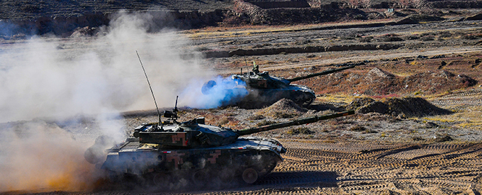
Remote surveillance of the battlefield dates at least to Napoleon’s time when hot air balloons were flown overhead to gain a better understanding of the terrain and the position of enemy troops. Today we call this Situational Awareness, and the applications are not limited to active war zones. Balloons have given way to aircraft, drones and satellites, and the onboard spotter taking notes has been replaced with sophisticated sensors and Artificial Intelligence-based data processing.
Remote sensing technologies have changed the way wars are waged and nations are defended. Natural and manmade topography worldwide has been mapped to submeter accuracy, and nearly every spot on the Earth’s surface can be observed safely and unobtrusively from a platform thousands of feet or hundreds of miles above. Few objects can remain hidden for long, whether cloaked by camouflage or darkness. Even a great military mind like Napoleon probably never dreamed of a day when too much data relating to field conditions or troop deployments would be considered a problem.
Yet here we are.
Defence & Intelligence (D&I) analysts – the tip of the spear when it comes to military situational awareness – face a challenge unprecedented in history. Varieties of complex data are coming in faster and in larger volumes than ever before.
“Data collection is no longer a major challenge for the D&I community,” said Jeff Hildebrandt, D&I Industry Principal, L3Harris Geospatial, a provider of software and services for the analysis and visualisation of remotely sensed data. “The problem for the analyst is sifting through the huge volumes of incoming data, finding the right data sets and extracting meaningful information from them.”
These remote sensing data management and information extraction issues are faced by geospatial end users in the private sector as well. The problem is even more acute for the D&I community because they typically have access to both commercial and military data collection assets, multiplying their challenges. Fortunately, solutions exist today to streamline the archiving, querying and retrieval of geospatial data so it can be disseminated to analysts and warfighters regardless of their location.
Just as importantly, software automation supported by Artificial Intelligence has put complex image processing and analysis capabilities within reach of every D&I analyst, allowing the first-pass review of raw data streams in some cases to be performed by machine and freeing the analyst to make critical final assessments.
Golden Age of Remote Sensing
For the typical geospatial professional, this may be considered a Golden Age of remote sensing. The availability of remotely sensed data has never been greater than it is today thanks to dramatic technological advances in sensors and the platforms that carry them. Two specific factors driving this phenomenon for both the government and commercial sectors are the proliferation of smallsats and unmanned aerial systems (UASs or drones). In the small-sats era, entire small satellite constellations can be built and launched for less than the cost of a single legacy platform like Landsat and SPOT. The upshot is that several small satellites can be configured in orbit to capture repeat data over a given point on Earth at a rate of at least once per day.
Closer to the ground, large military drones like the Predator have been deployed for well over a decade, but the low cost of smaller UAVs with surprisingly robust sensors has put these data capture devices in almost everyone’s hands, making an enormous volume of high-resolution image data and full motion video (FMV) available.
Specific to the warfighter and mission planner, two other remote sensing advancements are emerging rapidly.
Hyperspectral Sensors
The earliest Landsat satellites captured data in multiple bands of the electromagnetic spectrum, including the visible and near-infrared. Up to eight discrete bands are now collected by most ‘multispectral’ sensors. Led by airborne research sensors, ‘hyperspectral’ imaging is gaining traction with its dozens of individual spectra. NOAA and Indian Space Research Organisation have hyperspectral satellites under development, and the National Reconnaissance Office (NRO) was reported in late 2019 to commit funding for a spaceborne hyperspectral platform called HySpecIQ. These hyperspectral sensors will give data analysts next-generation insights into features on the ground.
Synthetic Aperture Radar
Unlike passive optical sensors that can only operate in daylight, synthetic aperture radar (SAR) systems are active sensors, which provide their own energy source, allowing them to collect data day or night, through clouds and in most weather conditions. The active sensors generate their own waves and collect the reflected and refracted response to gather unique information such as details of the composition, shape, configuration and other characteristics of surface features.
Managing Data with Jagwire
The data management challenge includes multiple issues – archiving, querying and dissemination.
L3Harris offers Jagwire, a battle-tested web-based software product providing an end-to-end geospatial data management solution and delivering near real-time search and discovery, image exploitation and information dissemination to the tactical edge. Jagwire is capable of ingesting enormous volumes of incoming geospatial data, including live video feeds, satellite imagery, LiDAR point clouds, and GIS vector layers. All an end-user needs to query and filter the data is web access on a computer, tablet or handheld device. No app or software is needed.
L3Harris is currently working on building web-accessible widgets that will allow some end users the ability to perform basic manipulation of the data sets via the interface. “The bottom line is that commanders want to get understandable geospatial information into the hands of people who can use it as quickly as possible.” said Todd Gerecke, Product Manager, L3Harris Geospatial.
Automating Information Extraction
Data management is critical, but it is only the first step in dealing with the tsunami of incoming geospatial data. The next step is extracting meaningful information from the wide variety of complex data sets now available.
L3Harris anticipated the approaching data tidal wave and developed an information extraction solution in the form of its commercially available ENVI software. Once a standard image processing package, ENVI has been enhanced and expanded to become a robust geospatial data analysis software that allows anyone with minimal training to extract meaningful information from all types of imagery – multispectral, hyperspectral, thermal, LIDAR and SAR.
ENVI is a baseline, commercial off-the-shelf software application used extensively by the D&I community and found on most analysts’ machines. “ENVI users don’t have to be remote sensing scientists or big data analysis experts to derive meaningful information from raw data sets,” said Hildebrandt. Leveraging decades of building geospatial solutions for the D&I community, L3Harris has developed science-based image analysis algorithms and integrated them into automated workflows in ENVI. This enables users to derive answers to the most complicated geospatial queries from enormous data sets with a few clicks of the mouse.
To facilitate common image analysis applications and requirements, L3Harris has bundled complex workflows into more than 200 automated modules or tools (often called ‘Tasks’). These span many functional areas including georeferencing, calibration, spectral analysis, morphological filters, classification, object detection, terrain modeling, point cloud analysis, SAR analysis, time series operations, machine learning /deep learning and many more.
In addition to identifying features, two or more images acquired over the same area on different dates can be loaded into ENVI FX, and with the push of a few buttons, the software identifies change that has occurred over time. The change can be natural or manmade.
Simplifying Information Extraction
As noted at the outset, data sets are becoming more complex, and Synthetic Aperture Radar (SAR) and Hyperspectral are the two leading examples. The complexity of these very useful types of data makes makes them particularly difficult to process and exploit. Again, L3Harris has leveraged the analytical capabilities in the ENVI software to automate many of the information extraction functions from these two data sets.
To make SAR data more user friendly, L3Harris has introduced ENVI SARscape, an analysis module that integrates multiple processing functions and algorithms into simplified, and in some cases, automated workflows.
“What sets SAR data apart from optical data for D&I analysts is its ability to see through clouds or at night to reveal what is happening on the ground any time of day in almost any conditions,” said Megan Gallagher, Solutions Engineer, L3Harris Geospatial.
With hyperspectral satellite imagery soon to be more readily available via the planned HySpecIQ and other commercial small satellites, military analysts will soon have greater access to the rich information that is contained in these complex data sets. ENVI was originally developed 30 years ago by a team of scientists at the University of Colorado to tap into hyperspectral imagery. L3Harris has continued its tradition of creating simplified pushbutton workflows for these data sets with a series of workflows called THOR or Tactical Hyperspectral Operations Resource. Similar to other ENVI tools, THOR workflows take numerous complicated processing algorithms and combine them into a single function, enabling end-users with minimal geospatial expertise to render actionable intelligence from the many bands of a hyperspectral image.
Among the most popular THOR workflows for military analysts are:
> Anomaly Detection
> Change Detection
> Target Detection
Customising Analytics with Deep Learning
The identification of specific objects in optical imagery, LiDAR point clouds and SAR data sets has been facilitated by automated recognition and extraction using the ENVI FX module and other workflows. While manual mapping of certain items, such as roads, rivers, fields and trees has been replaced by automated methodologies, there are still numerous other features that military analysts need to find and map in remotely sensed data sets.
ENVI has a solution for this challenge as well – the ENVI Deep Learning Module. A form of Artificial Intelligence, Deep Learning enables the user to ‘teach’ the software how to recognise nearly any feature or condition in the data set by its spatial, spectral or other characteristics.
“As with the other ENVI modules, you don’t have to be an Artificial Intelligence expert to use the ENVI Deep Learning module,” said Zachary Norman, Product Manager, L3Harris Geospatial. “The module has intuitive tools and workflows that enable users to easily label data and generate models with the click of a button.”
D&I analysts have embraced the ENVI Deep Learning module for the significant savings in time and effort it provides them, compared with manual processes. In a common example, an analyst ‘taught’ the module to identify damaged buildings using multispectral imagery of a Caribbean Island following a hurricane. In a matter of seconds, the module then identified thousands of similar structures that would have taken days to map manually. More importantly, the same Deep Learning algorithm can be applied repeatedly with new images as they are collected.
Delivering Consistent, Understandable Information
Another challenge for analysts in the D&I community has been ensuring the information extracted from geospatial data is understood in a consistent manner by end-users across a broad spectrum of groups. This is critically important, for example, when commanders from different branches of the U.S. military and Allied organisations are receiving assessments.
D&I analysts have embraced the ENVI Deep Learning module for the significant savings in time and effort it provides them, compared with manual processes.
L3Harris borrowed the NGA template and created an ENVI plugin called Report Generator, which automates the configuration of geospatial information and assessments for output in the official NGA format.
“Report Generator ensures everyone across the entire U.S. government – not just the military – sees the same information presented the exact same way,” according to Eduardo Iturrate, Senior Engineering Manager, L3Harris. “This ensures the information and its interpretation are consistent.”


No Comments